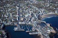
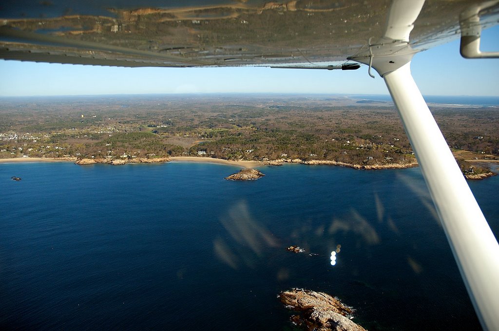
After departing the Boston class bravo airspace, a quick turn east through the Beverly class delta led to the southern side of Cape Ann......the "other cape". Throttling back to 90 knots and dropping to 1,000 feet gave some beautiful views of the beaches. 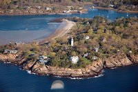 The first town I encountered was Mancheter-by-the-Sea. The entrance to Manchester harbor is seen just beyond Long Beach. The lighthouse is the Seacrest Tower House, originally a dreary governmental edifice erected as an observation tower during World War II.
 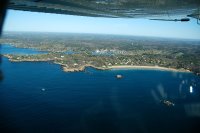 On the eastern side of Gales Point is Singing Beach, so named to describe the sound made by the fine grained sand as you walk on it.
 Singing Beach is on the far left and Graves Beach on the far right. The near island is Graves Island.
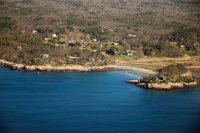 Proceeding further east, I flew over White Beach and Crow Island. The island actually looks more like a peninsula, it is separated from the Cape by some salt marshes.
 Coolidge Point is a small peninsula separating Kelltle cove from Magnolia Harbor. At the tip of Coolidge Point is the magnificent Ocean Lawn. At one time, this vast lawn was the site of the Coolidge family's "Marble Palace," a Georgian-style mansion designed in 1902 by Charles McKim under the direction of Thomas Jefferson Coolidge, Jr. The Ocean Lawn is now an open, grassy expanse broken only by large shade trees.
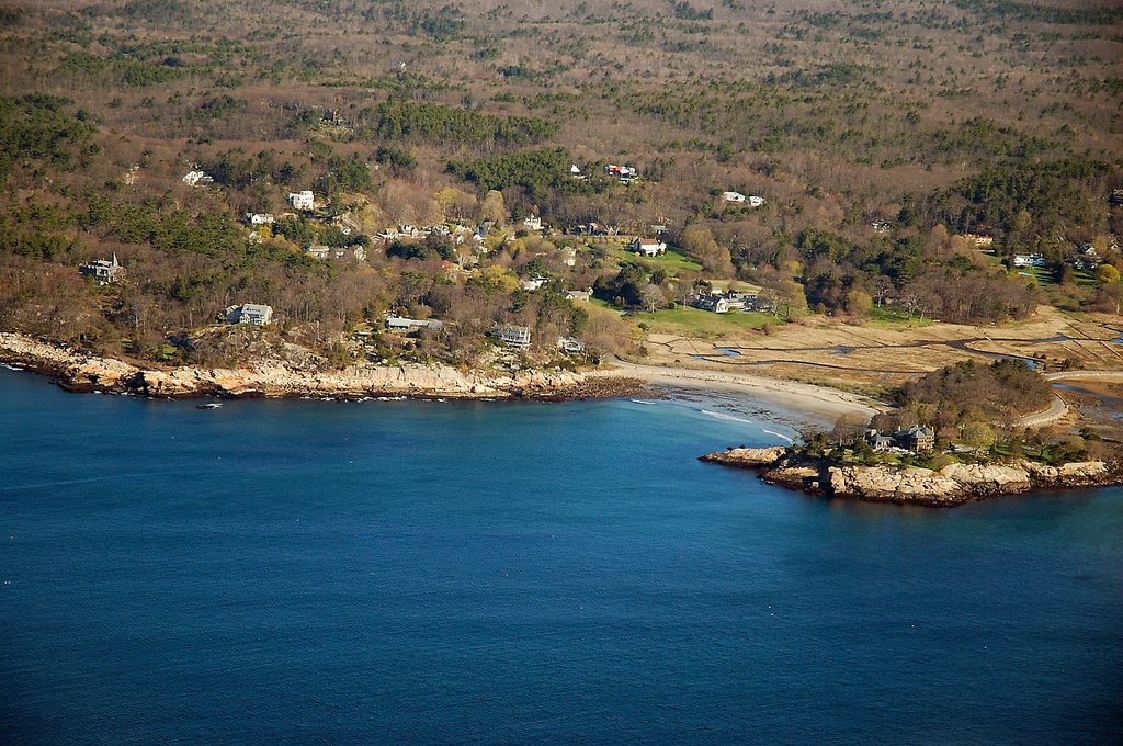
 Beyond Collidge point lay the last beach in Manchester-by-the Sea, Gray Beach in Kettle Cove. From Kettle Cove eastward starts the town of Gloucester.
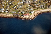 The village of Magnolia and Magnolia Point mark the southwest-most extreme of Gloucester. Some of the oceanside houses are quite impressive, such as the little cabin to the left. I'll have to drive down here some time, the view from the shore must be incredible.
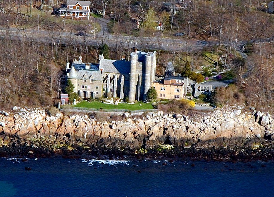
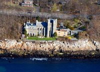 East beyond Magnolia Point I could see what looks like a medieval castle situated on rocks over the water. This is Hammond Castle Museum on Normans Woe Cove. Hammond, an inventor whose number of patenets is second only to Thomas Alva Edison, used this as a home in the 1920's. The home served as a backdrop for his collection of Roman, medieval, and Renaissance artifacts and is a museum today.
 In front of the nose of my aircraft lay Glouster harbor. The small island off of the left shore is Normans Woe Reef. The spit of land to the right is Eastern Point with the Dog Bar Breakwater forming a conspicuously straight line protruding into the harbor. The town of Gloucester itself lies at the extreme end of the harbor.
 After a few minutes, Dolliver Neck and Freshwater Cove pass by on my left.. J.P. Baekland (inventor of Bakelite, the world's first entirely synthetic plastic.) build some houses there for his sisters in the early 1900's.
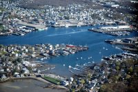
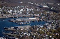
 I turned the plane to parallel the south shore of Gloucester Harbor, priding itself "America's oldest seaport". This harbor has had commercial fishing traffic since 1623. The shoreline is Pavilion Beach which has a public promenade and includes the famed Fisherma's Monument. The near island with the small lighthouse is Tenpound Island, so named for the amount paid the indians to relinquish the island. Over the centuries, it was the last land seen by many fisherman lost at sea.
 The far shore of the working waterfront is Fort Point which defines a small channel. The near shore is part of Rocky Neck. The reddish brown building with the tall stack is Tarr & Wonson Paint Company. Twelve years after the Civil War, workers here revolutionized the fishing industry, creating copper-based paint that allowed fishermen to protect their boats from the barnacles that attach to the vessels on long trips.
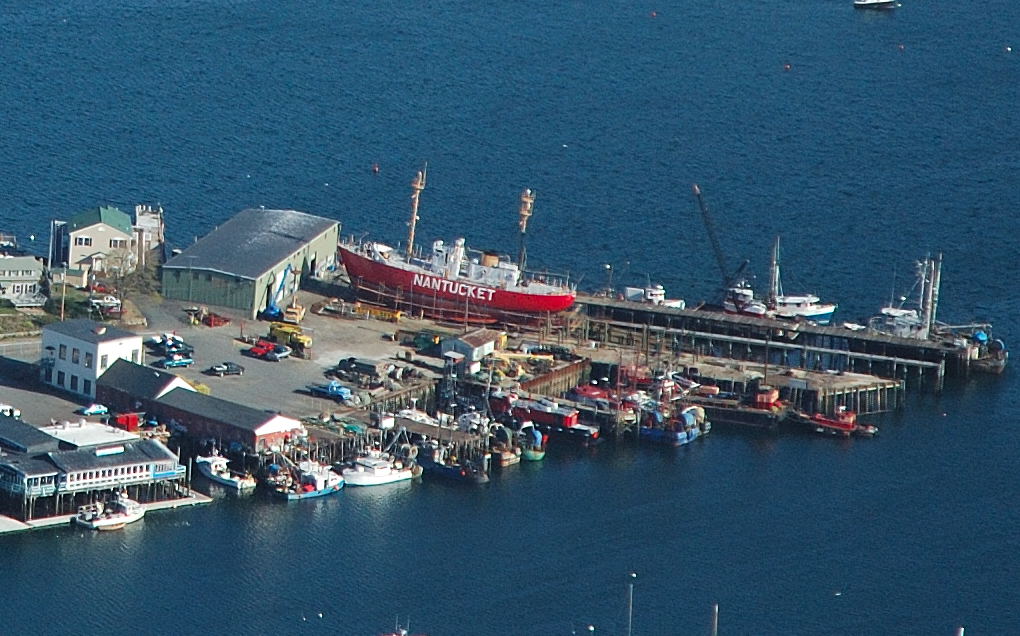
 Further down the inner harbor there is a Maritime museum behind the turquoise colored ship. Next to this ship is a replica of the long liner "Andrea Gail" from the Movie The Perfect Storm. The bright red boat is a lightship drydocked at the Gloucester Maritime Railway.
 The large pier at the center of the photo is the State Fish Pier.
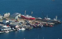 A closeup of this boat shows it to be the "Nantucket", the last serving lightship. Lightships served for decades as floating lighthouses to help ships navigate some of the most dangerous of U.S. coastal waters. From 1856 to 1983, a lightship was stationed off Nantucket to help trans-Atlantic and coastal ships traverse the treacherous Nantucket shoals, where in 1956 the Italian luxury liner Andrea Doria collided with the Swedish liner Stockholm in the fog, with the loss of more than 50 lives. They have since been replaced by buoys.
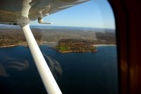
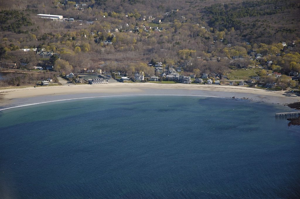
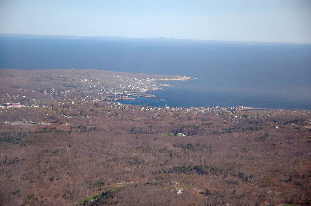
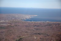 After crossing Eastern Point, the next destination, Rockport could be seen in the distance. But before turning north, I wanted to overfly Good Harbor beach, which I had visited with my two small kids in past years.
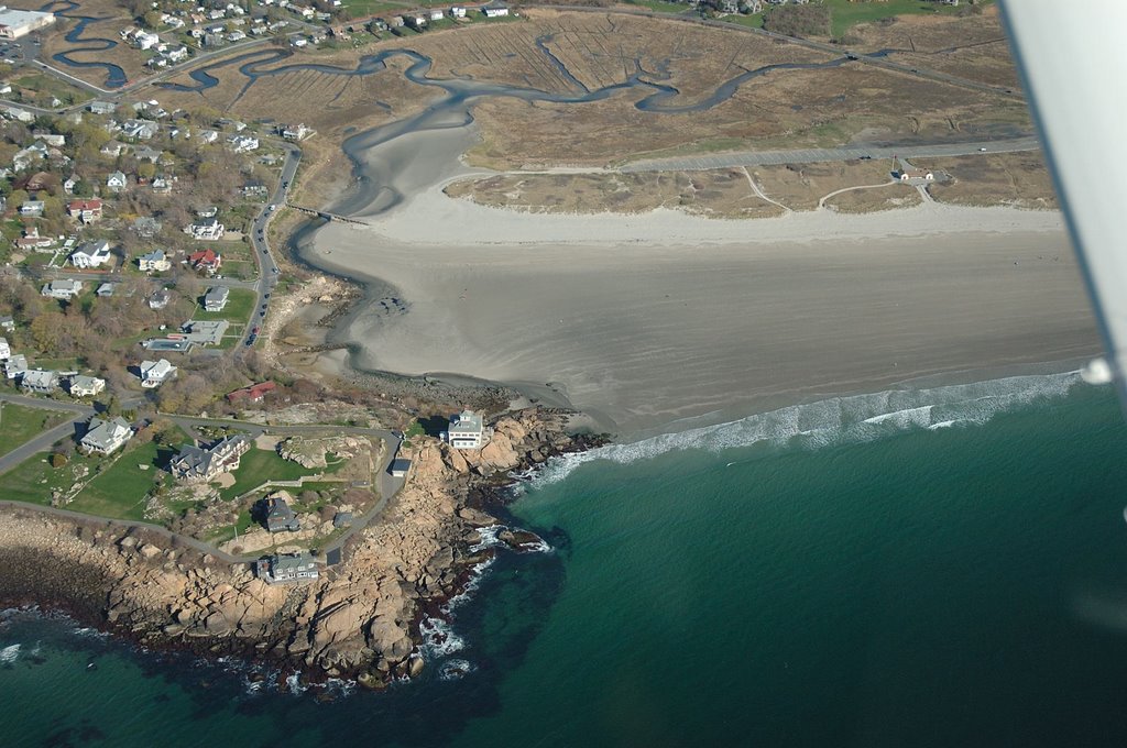
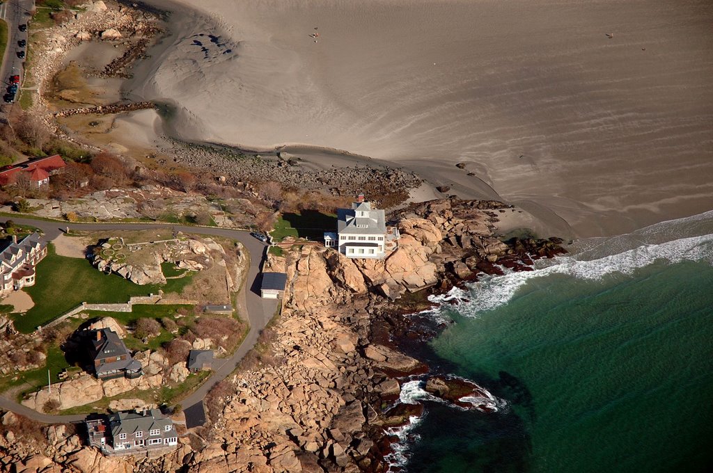
 We have always stood in awe of the house perched on a rock on the edge of Good Harbor Beach. From the air it is no less impressive. It looks as if the house is waiting on the edge of the cliff, waiting to get enough nerve to just jump in! The water was clear enough to make out some subsurface features and I brought the plane to about 800 feet to make out the small footbridge that connects the beach to the road.
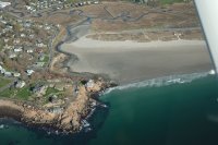
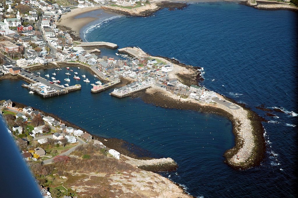
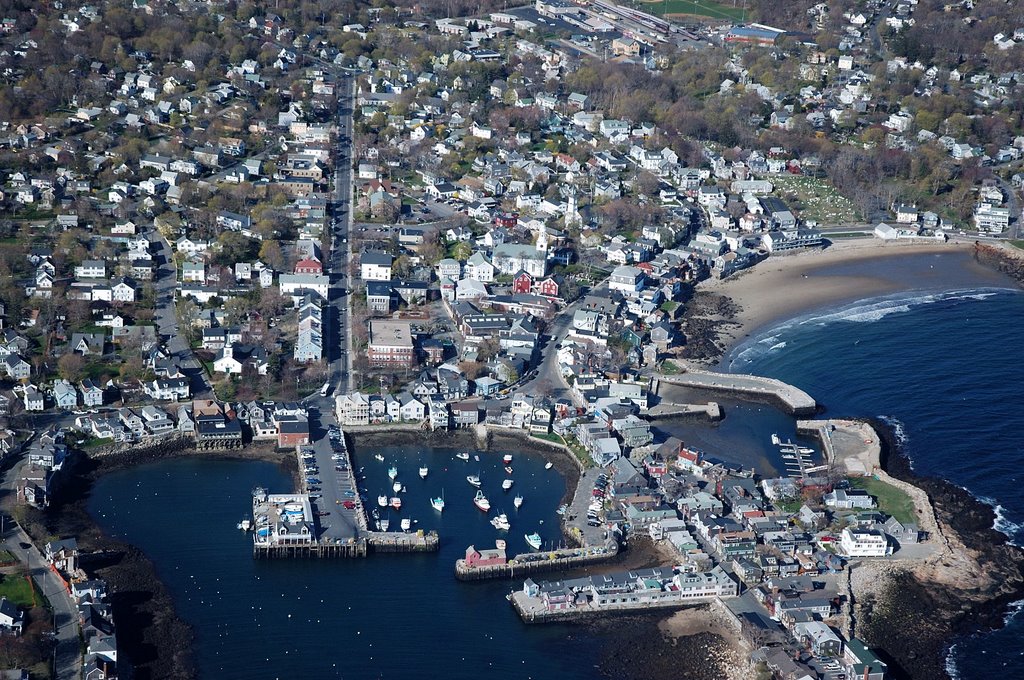
 Finally, I made a sweeping turn to the north, staying away from Thatcher Island which is a wildlife sanctuary and approached Rockport. The harbor is well protected by inner breakwaters as well as an outer harbor formed by Bearskin Neck.Front Beach can be seen nea the top center of the photograph.
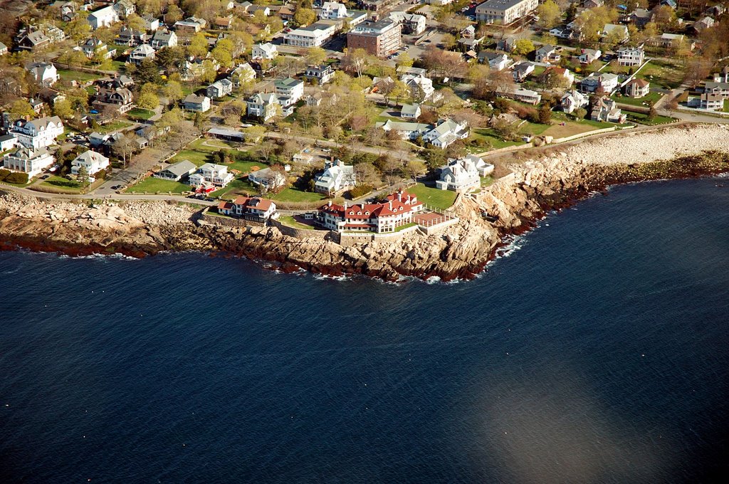
 Passing abeam of Rockport, I could see right down Broadway itself. T-wharf is an extension of Broadway. Perpendicular and closest to T-wharf is Bradley wharf and parallel to it is Tuna wharf. The old harbor can be seen at right center in the photo.
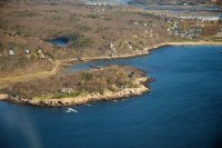
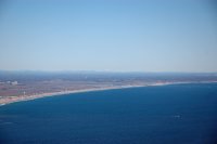
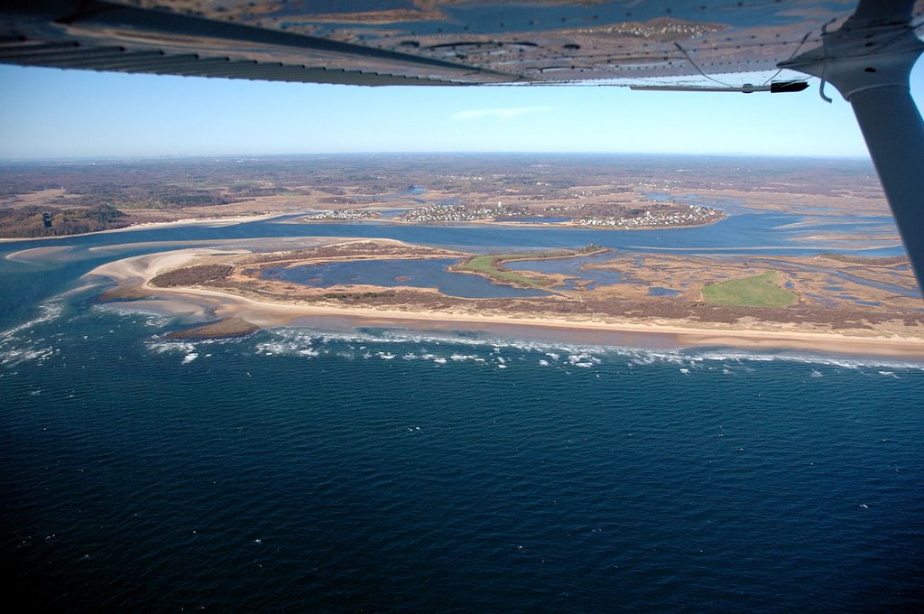
 From Rockport, I made a direct line to Ipswich, crossing over Ipswich Bay and making landfall at the southermost tip of Plum Island. In the photoyou can see the Plum Island River as it empies into Ipswich Bay. The houses are on Little and Great Necks, both part of the town of Ipswich. I turned the plane north to follow the coastline, keeping clear of Parker River National Wildlife refuge. I decended to minimum legal altitude of 500 feet....I tell you, it seems a lot lower, like your going to get the main gear of the old Cassna a little wet. A little power and bach up to 1,200 for the rest of the trip up the coast.
 Suprisingly, there was some whiteness in the distance. At first I though that they were clouds but a quick glance though the telephoto lens proved me wrong. Mt Washington. I turned the white target directly in front of the aircraft nose and checked the GPS. No mistake, that really was Mt. Washington at a distance of over 100 miles! Puts the term "unlimited visibility" into context for you!
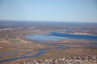
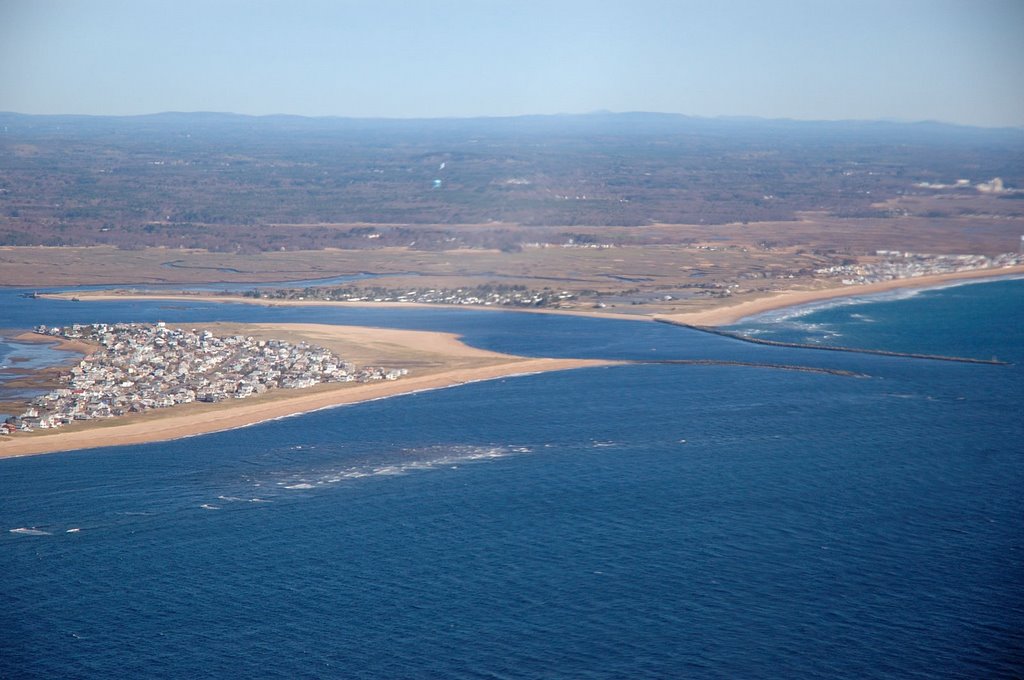
 Finally, I arrived at the northermost end of Plum Island. The Merrimack River could be seen emptying into the ocean. I had to maneuver to keep clear of a small plane departing Plum Island airport. At this point I decided I had enough fun for the day and punched up KBED on the GPS and started a direct track back to Hanscom.
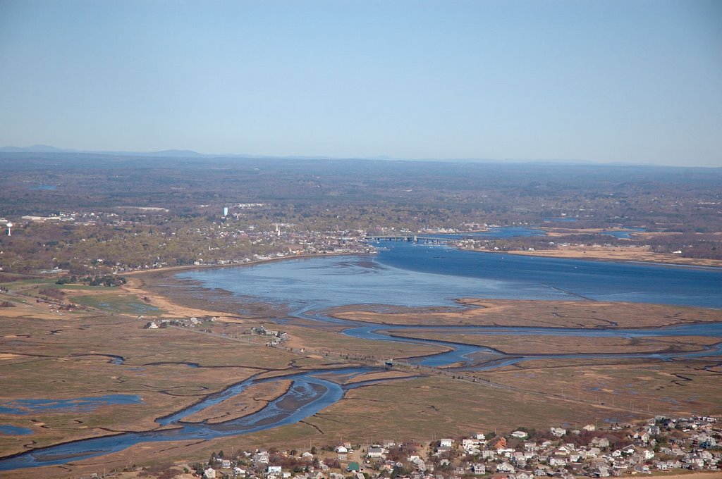
 The left turn over the inlet gave me my final view of Newburyport. The Route 1 bridge can be seen crossing the Merrimack river and the faint arch of a bridge further upriver is the I-95 bridge. If you expand the picture, in the lower left corner the runway for Plum Island airport can be seen running parallel to Plum Island turnpike.
Passing through Lawrence airspace, I picked up the ATIS for Hanscom and entered the left downwind for runway 11. Once again, it seemed as if chased airspeeds a little on final approach, but this had to do with the visual depeiction of the airspeed tape. One more hop in the G-1000 and I should be checked out. All in all, this was a great day.....new aircraft checkout and a combined downtown/Cape Ann/Plum Island tour in a mere 1.4 hours of Hobbs time. This itinerary is definitely a keeper!


