26 Feb 2006: Cross Country to Catalina Island.
 A rash of bad weather in the Boston area and a business trip to California prompted me to evaluate the possibility of renting a plane while on the west coast. I'd be staying in Rancho Bernardo, north of San Diego and about 9 miles from Ramona Airport.
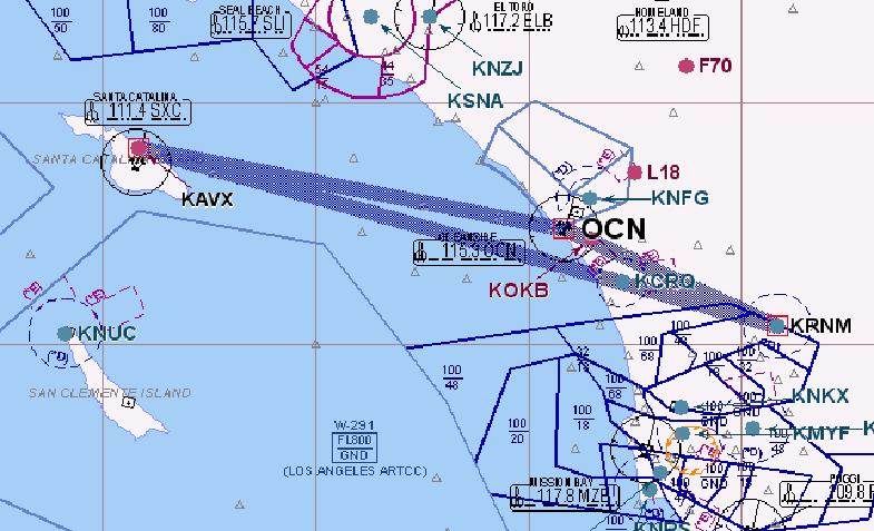 When I awoke, there was a pretty substantial layer of low clouds that obscured the mountains. A call to San Diego Flight Service Station confirmed it was a typical marine layer that moved in overnight but was expected to burn off by mid-morning. Winds at altitude were light at about 10 knots from the west, pretty much an ideal day was shaping up.
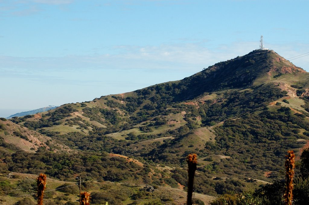
 I started driving to Ramona airport which is situated in the hills above Rancho Bernardo at about 1600 feet. The drive to the airport wound it's way through some pretty impressive elevation gains and I realized that this was indeed mountainous terrain compared to what I was used to. Every once in a while, a jackrabbit would dart across the road . When I turned into the airport, I was greeted by tumbleweed rolling toward the runway! Darn! I forgot my spurs at home!
Jim, the chief flight instructor met me as I pulled up to the hangar. He seemed like a pretty normal guy. By this point I was expecting some chewing-tobacco spitting cowboy to come out and give me the "Saddle-up, we're burnin' daylight" speech. (apologies to John Wayne).
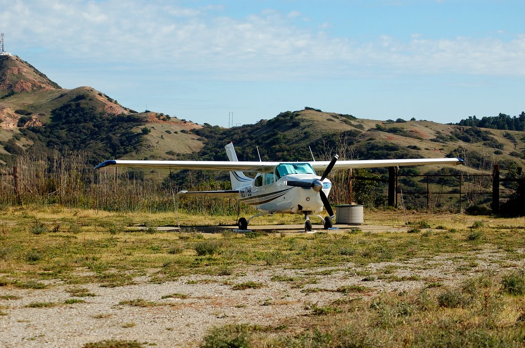
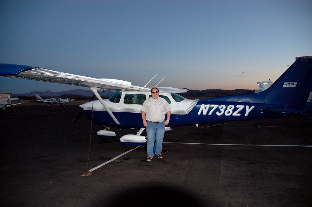
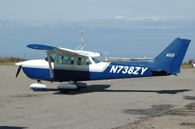
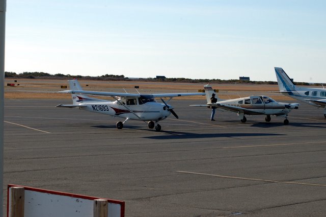
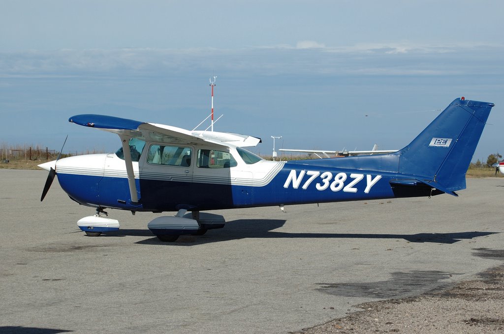 He said that Dino, my CFII would be by eventually and I'd be flying N738ZY, an older Cessna 172. I'd forgotten what the older 172's were like, lots of cracked plastric and fairings. This one had a 160 HP carbureted Lycoming engine out front, an ADF, DME (inoperative), STEC autopilot (inoperative), strobes (inoperative) but a nice new Garmin GPS. It also had extended tange tanks but the electric boost pumps for them were...........you guessed it, inoperative. The package was rounded out by some STOL wingtips and a stall fence. At least the paint job was nice, a dark blue and white pattern that looked fairly new. Yup, we'd at least look good in the 6 o'clock news photos showing the Cessna that landed on the freeway after an engine failure !
Dino arrived after I preflighted. We exchanged some info on experience levels and I taxied to runway 27 after programming my flight plan into the GPS: Catalina airport via the Oceanside and Catalina VORs; 81 miles total, 57 of which would be over the ocean. We were carrying life jackets but they were stowed away in the back of the plane. I hoped we'd get enough glide time to be able to get them out and on in the event of an engine failure. While we taxied, some more tumbleweed rolled across the runway. Yiiiiiii-Haaaaaaa pardner! We're a going to go flyin'!
After the runup, I was cleared by the tower for takeoff. After flying 172SP's at Hanscom, this plane seemed a bit sluggish and after rotation, took forever to get into the air. At 70 knots climb speed, we were showing about 300-400 foot per minute climb rate. Boy, on a hot and humid summer day density altitude would make this an interesting takeoff. A small right turn kept us clear of the hills that surrounded Ramona (It's essentially in the bottom of a bowl, surrounded by rocky hills). I turned toward the Oceanside VOR and contacted SOCAL Approach for flight following.
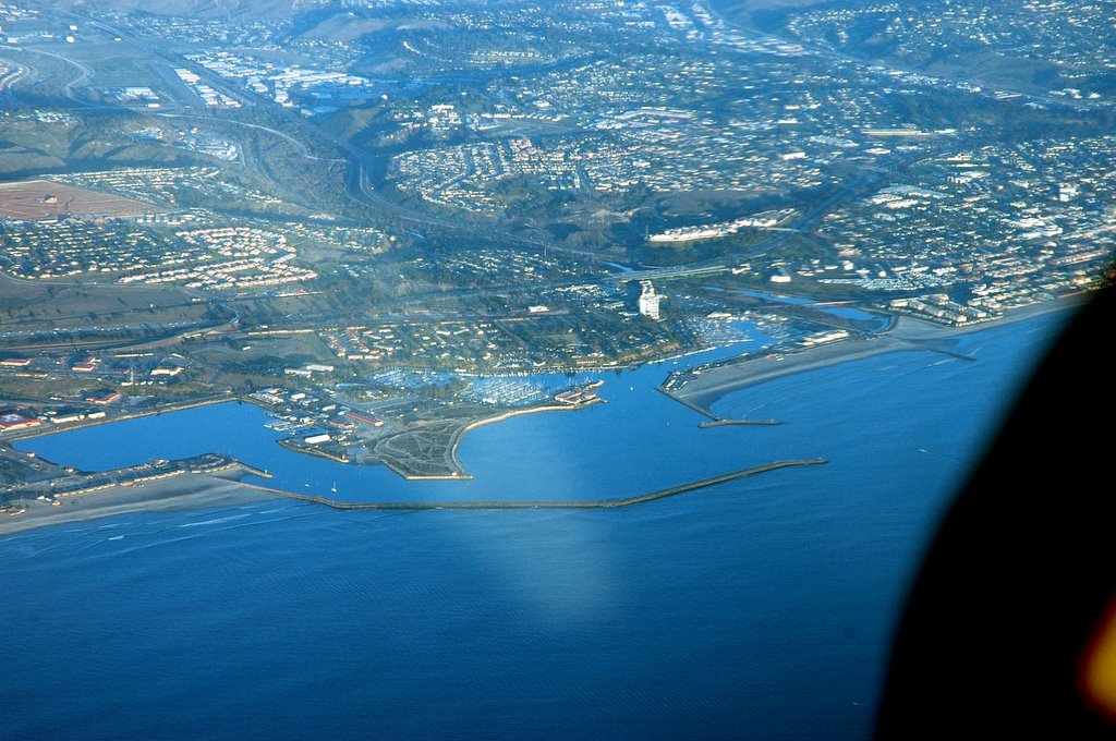
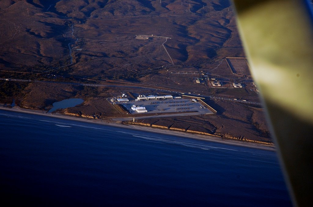 The climb to 6,500 feet took almost all of the leg to Oceanside but the view was beautiful. Camp Pendleton was on the right and you could see the huge hangars on the beach that housed the Marine Corps' assault hovercrafts. To the left were the hill surrounding Palomar airport and in the distance, the skyline of San Diego and the hills at Point Loma. There were high white cliffs down the south coast which were probably Torrey Pines near La Jolla.
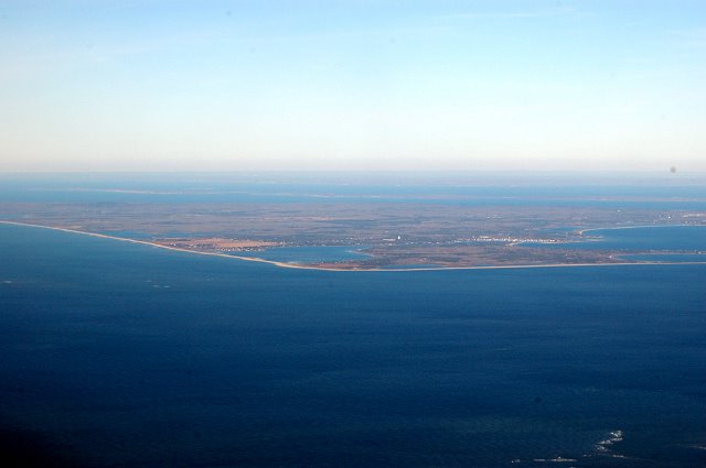
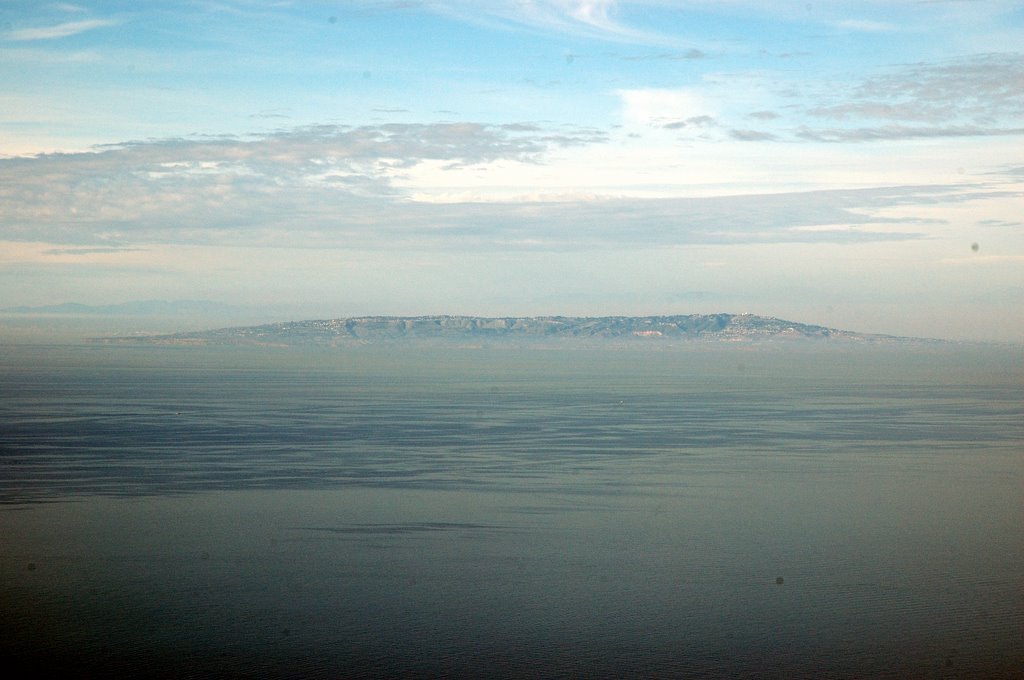
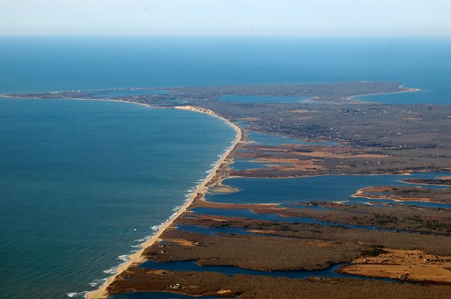
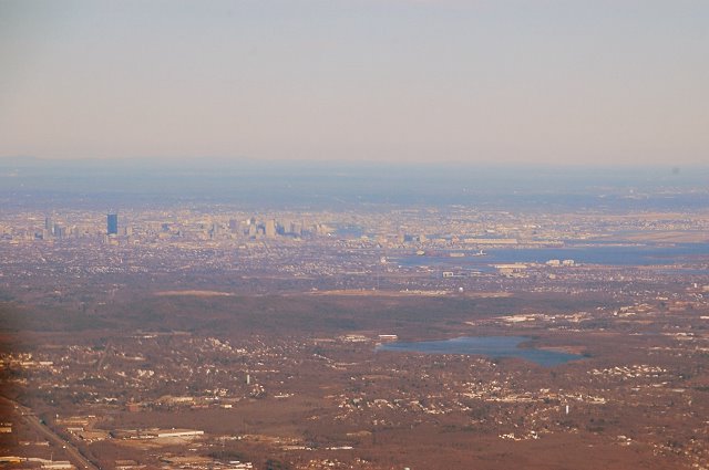
 Once we hit the Oceanside VOR, a 20 degree turn to the left headed us out to sea with Catalina Island visible in the distance
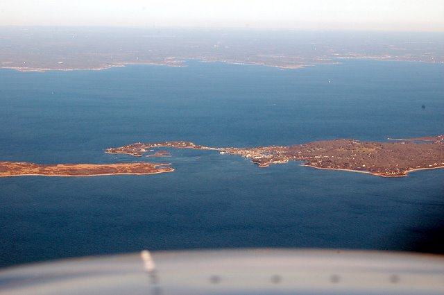
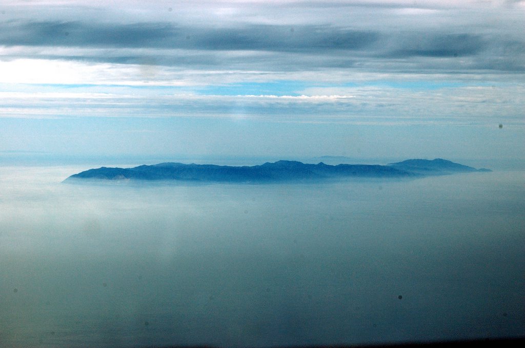 rising out of the haze. Immediately to the left of Catalina was San Clemente Island and now that we were over the water, Los Angeles could be seen in the distance with jet traffic descending onto LAX's runways. It was unnerving to be flying over so much water, we were well outside of gliding distance to the shore. But the air was smooth and we were showing about 102 knots groundspeed on the GPS.
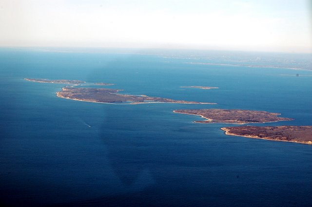
As we approached Catalina, you could make out the cliffs rising steeply from the rocky shoreline to about 2,000 feet in height. We flew just offshore above Avalon, Catalina's only town.
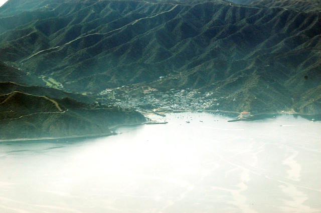
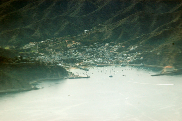
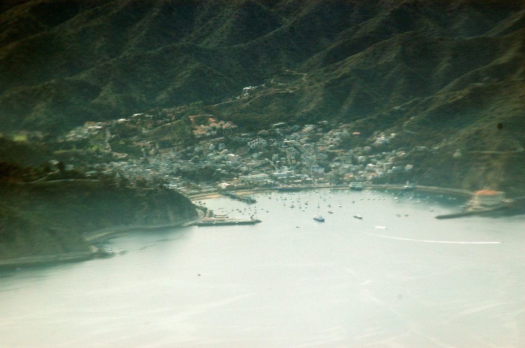 It basically is a small marina and village wedged into a very steep cove on the eastern side of the island.You could see about 30 speedboats all leaving the harbor at the same time, seemingly racing toward the east. The island itself was a mass of steep mountains covered in boulders. No consolation here after the long overwater flight. If there were an engine failure, the best bet would still be to ditch in the ocean. There were no flat spots to set down at all!
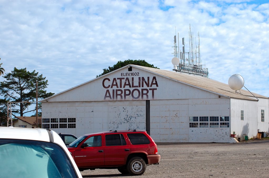
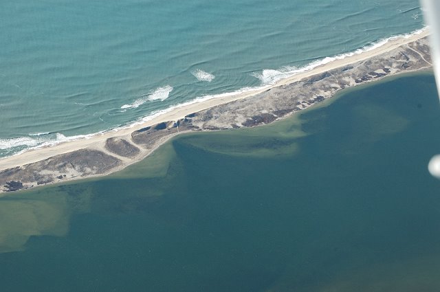
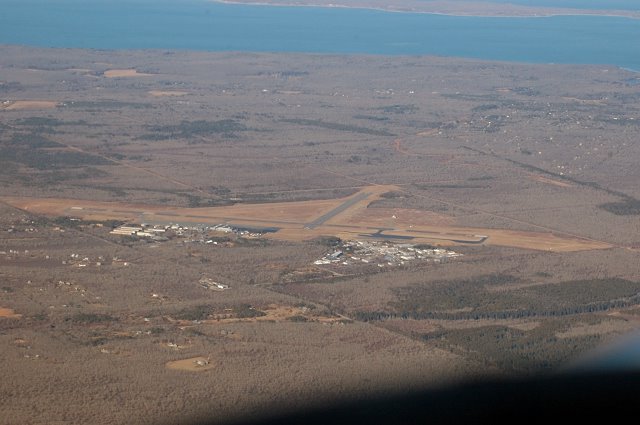
 Finally, the airport came into sight. They didn't nickname Catalina Airport the "Airport in the Clouds" for nothing. The runway starts at the very edge of a 1,600 foot cliff and angled upwards at a 4 degree angle. Dino suggested I descend between 2 mountain peaks that seemed rather close together in my opinion, but I passed through them with a minimum of turbulence. I overflew the runway at 3,500 feet, announce my intentions on the UNICOM and turned back to the right to start my downwind leg, entering the downwind and slowing to 90 knots. After turning base and then final, I was astounded by what I saw.
 The view was like I've seen in movies about aircraft carrier landings and it was clear that in my apprehension of losing too much altitude, I was coming in to hot and high so the CFII suggested I make a 360 degree turn to bleed off altitude. I did, but without the visual cues you normally have at the approach end of the runway, I kept thinking we were too low and were going to smack into the side of the cliff. The key to Catalina is fly the altimeter then focus on the runway............all of the cliffs and hills just distract you.
I finally crossed the threshold and flared touching the mains down and started the rollout. Everything was great until I touched the nosewheel down; the whole plane began to shake violently. Broken shimmy dampener!
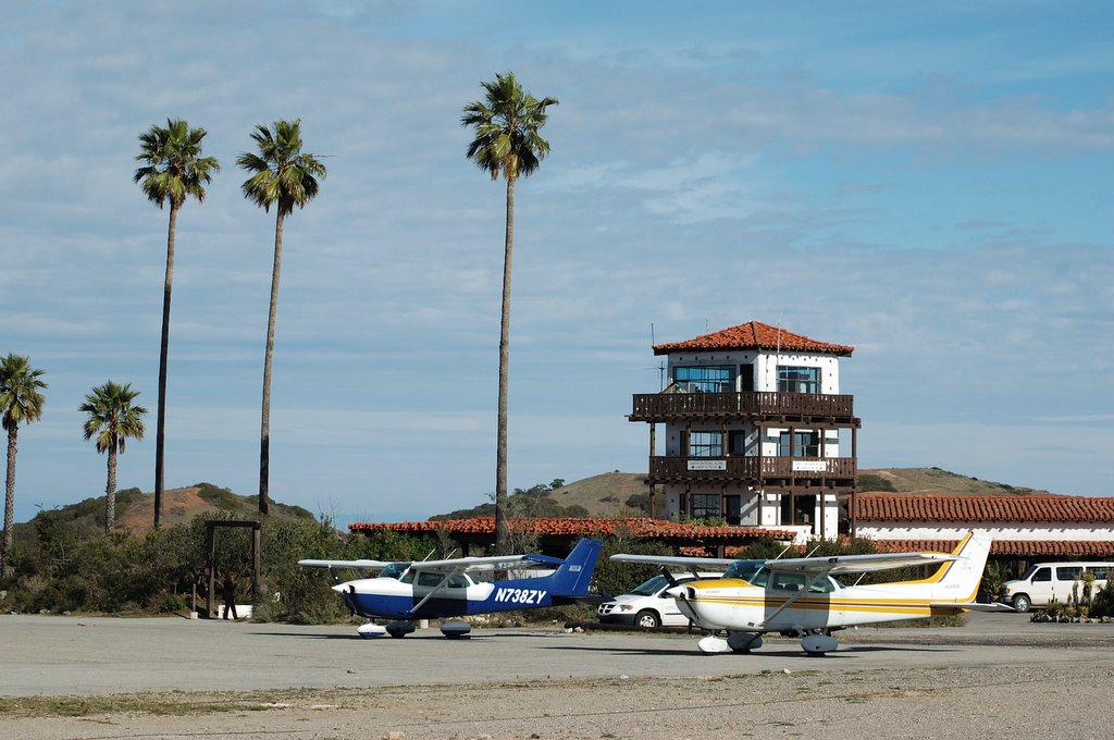 I pulled back on the yoke to shift weight back onto the main landing gear and taxied to a tie town spot on the ramp dodging the numerous potholes on the runway. Dino seemed pretty unconcerned, apparently the plane always does that (little consolation). I shut down and climbed out to look around.
The view was unbelievable. Palm trees swayed in the warm breeze. We walked to the approach end of the runway and looked over a 1,600 foot drop off to the ocean below.
 This approach is usually leeward of the prevailing wind and there is often a very strond downdraft as you approach the runway.
 The key is to carry a little extra power in the apprach and be ready to add power IMMEDIATELY if a high sink rate is encountered.
In one direction was a 500 foot peak with some antennae on top of it and an adjoining peak,
 the ones we passed between on the approach and they looked no farther apart then they did from the air. There was a sign on a fence that warned you of appoaching buffalo. Buffalo ??!! Apparently, there were some buffalo brough to the island years ago that have since prospered and they roam around at will, occasionally grazing on the airport grounds. There were no "tatanka" in sight at that moment (the only Sioux word I know thanks to Dances with Wolves) so we headed over to the restaraunt for a buffalo burger in tribute. The restaraunt is old and rustic with a stone fireplace and a veranda overlooking the beautiful scenery. We had a couple of buffalo burgers which are, by the way, made from Colorado buffalo. As the woman behind the counter said, "We don't eat our own!" OK, no offense meant! Didn't realize you were part buffalo!
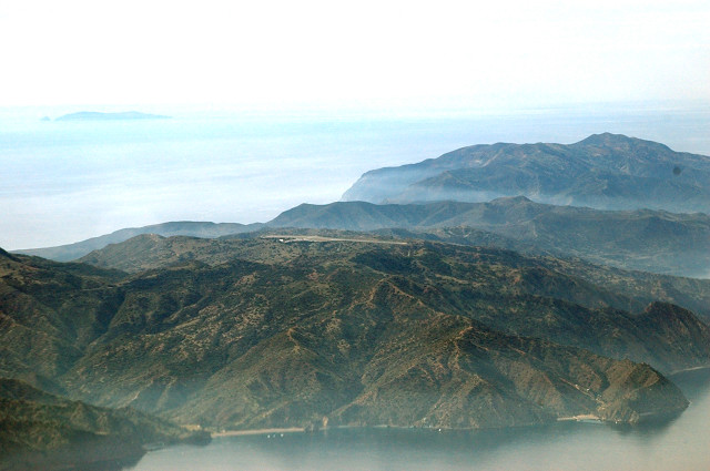
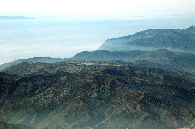
 In the distance, one could make out LA, the Hollywood hills and Pacific Palisades. The houses you see in the picture are mansions above Malibu including Cher's place. Must be nice!
After about 2 hoursof walking around, we saddled up for the flight back. As we were taxiing, a voice came over the UNICOM.
"Cessna 738ZY, Catalina Unicom. Have you paid you landing fee and registered at the tower?"
"Negative Catalina. Could I just mail you the cash?"
"Negative 8ZY. Return to the ramp and pay the fee in person."
Between, tumbleweed, jackrabbits and buffalo, I figured I'd better comply or wind up with a feathered arrow through my head. I spun the plane around, found a place to park and shut down.
 Hiking around some planes tied down amid the cacti, I finally climbed the stairs to the tower and paid the $20 landing fee. They gentleman in the tower was very cordial and said people forgot it all the time. Many ignore his radio call and depart without paying so he was appreciative that I stopped to pay up. Up in the tower was a distraught woman whose Piper Archer II had broken down and she was trying to figure how to get a repair mechanic out to the island. (Catalina has no mechanic, fuel or other aviation services.) I got back to the plane and started up again.
By now, the sun was getting low and we were taking off on runway 22 right into it. I taxied to the very edge of the runway (and cliff, by the way) to make sure I had every available inch of asphalt available. With the throttle firewalled, the airplane accelerated uphill very sluggishly and then that darned nosewheel started shaking like crazy again. I realized that it was eating up my speed so I pulled back on the yoke and raised the nosewheel off of the ground and flew into ground effect. We were accelerating to 70 knots and about 30 feet off of the runway when we reached the other end and the cliff fell off into the Pacific Ocean. That is a visual memory I will not soon forget, exhillerating and terrifying at the same time.
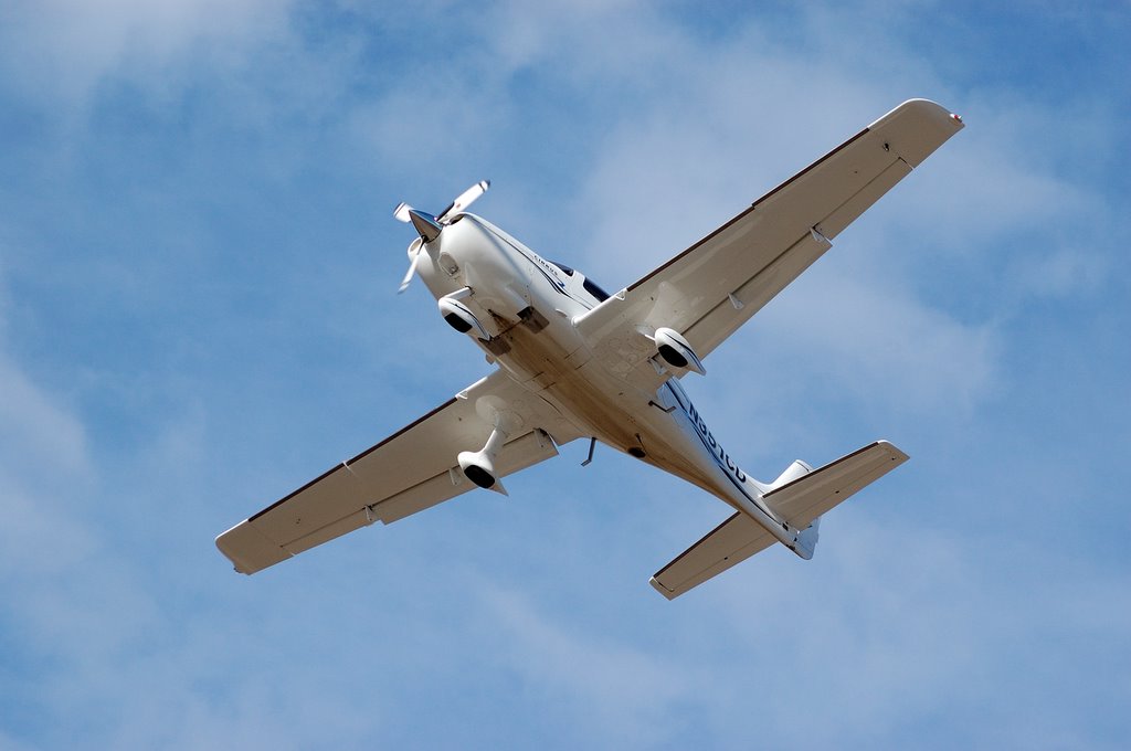 An earlier Cirrus had the same experience, just passing over my head as I took in the view at the departure end of the runway.
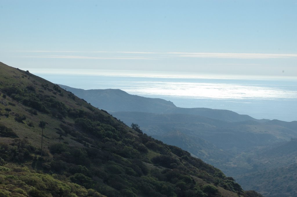
Since it was getting late, I decided not to circle he island but headed direct to Oceanside VOR at 5,500 feet. SOCAL approach cleared us direct to Ramona, passing over the Camp Pandleton restricted area. Dino took the controls so I could get some photos.
 After the 30 minutes overwater, it was nice to get back within gliding distance of Oceanside and Palomar Airport in Carlsbad. SOCAL Approach cleared me to descend at my discretion so I began the approach into the Ramona bowl, crossing some rather menacing hills but appreciating the absolutely gorgeous views of the mountains and valleys. The tower gave me the option for approach so I chose a left downwind for runway 27. The landing was a bit hard and I was surprised just how fast that beast settled when the power came off.
  We taxied back to the tiedown just as it was getting dark and the field lights were coming on.
 What a great day! Rabbits and buffalo, mountains and ocean, tumbleweed and cactus all topped off by 2.1 hours of flying to one of the prettiest and most challenging destinations I've seen to date.
posted by Robert at 6:51 AM
2 comments
![]()


